
Project

Smart green space management for livable cities

Green Ecolution is an open-source solution for the efficient irrigation of urban trees. Our software combines sensor data with intelligent route optimization, enabling targeted, resource-efficient deployment planning. Developed in collaboration with the City of Flensburg, and soon available for your municipality too.

Software

Well-founded recommendations for irrigation at a glance

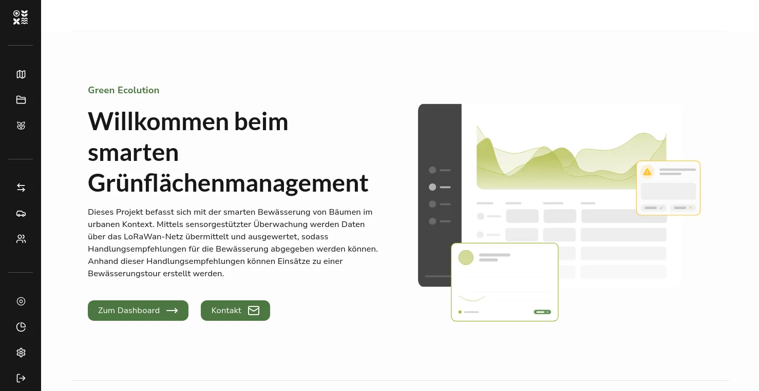
Our system scientifically evaluates the sensor data and shows when irrigation is needed. The data is prepared so that it is easy to interpret and can be directly incorporated into deployment planning.
app.green-ecolution.de
Green Ecolution dashboard - overview of irrigation recommendations
Process

Measure. Understand. Act.

From soil moisture to an optimized irrigation route, in one continuous digital workflow.

01 · Capture

Measure

Soil moisture sensors capture parameters such as soil moisture, temperature, and soil water tension at multiple depths (30/60/90 cm). The data is transmitted energy-efficiently via LoRaWAN.

  • Soil moisture sensors at depths of 30, 60, and 90 cm
  • Measurement of soil moisture, temperature, and soil water tension
  • Energy-efficient transmission via LoRaWAN
  • Flush-mounted installation, no impact on maintenance work
02 · Analyze

Understand

A traffic-light system shows the current irrigation need on a map. Staff can see at a glance which green spaces need water. Time series enable detailed analyses.

  • Traffic-light system shows irrigation needs on a map
  • Prioritization by urgency when capacity is limited
  • Time series for soil moisture, temperature, and water tension
  • Real-time dashboard with all relevant KPIs
03 · Execute

Act

Automated dispatch and route planning generates optimized irrigation routes, taking into account water capacity, vehicle size, and road restrictions.

  • Automated dispatch and route planning
  • Takes water capacity and vehicle size into account
  • Road and access restrictions included
  • Export of routes to navigation devices
System Architecture

The path of the data

This is how the readings travel from the tree to the optimized irrigation route through the Green Ecolution system.

01

Sensor

Measures soil moisture at the tree

02

Gateway

LoRaWAN transmission

03

Backend

Data processing & analysis

04

Dashboard

Visualization & route planning

Route optimisation in the backend is handled by Streamlet, a separate open source project that can also be used outside Green Ecolution.

Governance

Open source as a principle

Transparency, independence, and reusability: the cornerstones of our open-source strategy.

License

AGPL-3.0-only

Licensed under the AGPL. Funded as part of DigitalHub.SH's "Offene Innovation" ("Open Innovation") state program.

Sovereignty

Digital sovereignty

No dependency on proprietary platforms. Municipalities retain control over their data and infrastructure. No vendor lock-in.

Modularity

Plugin system

Modular extensions for municipality-specific adaptations without changing the core software. Import plugins for tree registries, CSV, and databases.

Integration

API-first

Open interfaces for integration into municipal IT landscapes. Connection to IoT hubs and open data portals.

Community

Reuse & community

Source code and documentation are publicly available on GitHub. Other municipalities can reuse and adapt the solution.

Cost efficiency

Cost efficiency

No license fees. The business model is based on services: hosting, customization, and sensor distribution. Regional value creation in Schleswig-Holstein.

Advantages

All other features and advantages

The project is publicly viewable and aims to reduce water consumption for irrigation while enabling variable deployment planning.

An open solution for everyone

Scalable open-source solution for municipalities that promotes further development and transparency

Optimized routes

Individual deployment planning for more efficient irrigation

Less is more

Targeted irrigation, less water consumption

Vision

Made for every municipality

The platform is deliberately designed to be usable in any municipality. Map areas, organizational structures, and irrigation regions are freely configurable.

Only open standards and open-source components are used. A cloud-native architecture based on Kubernetes enables multi-tenant, highly available operation. Additional municipalities can easily be added.

Roadmap

Mobile app with QR scan

Completed

Sensor setup via QR code and GPS directly on-site at the tree

User and role concept

Completed

Fine-grained permission management for staff, service providers, and partner municipalities

In-house sensor firmware

In progress

Fully self-developed firmware for maximum control and adaptability

Open data export

Planned

Connection to the open data portal of the state of Schleswig-Holstein

Additional green space types

Planned

Expansion to flower beds, perennials, and parks beyond trees

···and much more in the pipeline

Resources

Further links & mentions

Contact

Let's become greener together

Do you have questions, feedback, or a request? We welcome your message and will get back to you as soon as possible.